Photo Links
Lakes & Parks Aerial Photos
Standing Bear Lake Ed Zorinsky Lake Wehrspann Lake
Mahoney Park #1 Mahoney Park #2
USCS 1999 Satellite Photo of "Mega-Church" by MSN TerraServer
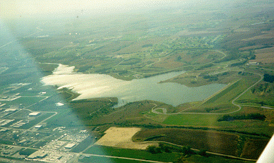
144th Street - Horizon street in the lower left corner of photo. Giles Road - Off the left edge of photo (not on photo). Cornhusker Road - Diagonal from the lake lower shore to lower left edge of photo.
Wehrspann Lake Lake - For Location see "Papio Lakes page" a Papio-Missouri River Natural Resources District - Flood Control Reservoirs
& Chalco Hills Recreation Area Map
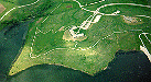
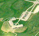
Natural Resources Center (Area above, left of the dam & the photo at right)
Looking North North-East NRD headquarter Below by Steve Adams-May 20,1993
A hike / bike trails system, The Papio Trails [map], will connect Omaha area parks and Papio lakes. Another Trails map from UNOmaha Map
Photo Above
Send your comments, suggestions or broken link reports to: sadams@Novia.net
The Aerial Photos background was drawn by Steve Adams. Last Update on February 12, 2004 at 16:00 UTC (10:00 am CST)