Photo Links
Lakes & Parks Aerial Photos
Standing Bear Lake Ed Zorinsky Lake Wehrspann Lake
Mahoney Park #1 Mahoney Park #2
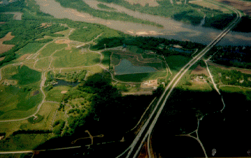
This photo taken by Steve Adams in the mid-afternoon of Thursday May 20, 1993
USCS 1999 Satellite Photo of "Museum & Mahoney SP" by MSN TerraServer Platte River - runs across the top of this photo. Interstate 80 - is on the right side of the photo.
Photo Above
Send your comments, suggestions or broken link reports to: sadams@Novia.net
The Aerial Photos background was drawn by Steve Adams. Last Update on February 24, 2004 at 17:45 UTC (11:45 am CST)