Photo Links

Lakes & Parks Aerial Photos

Photo Home | Map & List with Sm Photos | All Thumbnails
Downtown | South & Central Omaha | Universities | West Dodge | Lake & Parks

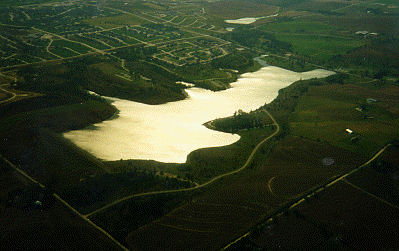
Standing Bear Lake
Ed Zorinsky Lake
Wehrspann Lake

Mahoney Park #1
Mahoney Park #2

Standing Bear lake
Looking Southwest


This photo taken by Steve Adams between 2 pm & 3pm on October 10, 1998

USCS 1999 Satellite Photo
 of "Mega-Church" by MSN TerraServer
Fort St.- Upper left to 144th street
Military Rd.- Diagonal across the
lower right of photo.
 
144th St. - across right end of lake.
132nd St. - Diagonal across the
lower left of photo.
Standing Bear Lake - For Location see "Papio Lakes page"
a Papio-Missouri River Natural Resources District - Flood Control Reservoirs

The Recreation Area has

  • Trails for bicycling, hiking and jogging
  • Fishing, boating
  • Picnic Areas & playground (Left shore of the lake)

Hawksfield - 500 ft paved asphalt runway
Short diagonal strip on the upper shore, at the end of road from Fort Street

A hike / bike trails system, The Papio Trails [map], will connect
Omaha Area parks and Papio lakes. Another Trails map
from UNOmaha Map


Photo Above

| Welcome | Links | Maps | Aerial Photos |


Send your comments, suggestions or broken link reports to:
sadams@Novia.net

The Aerial Photos background was drawn by Steve Adams.
Last Update on February 12, 2004  at 16:00 UTC (10:00 am CST)