Home > Trips > Twin Cities Index, Story & Map > Day 5

St Paul - Minneapolis
International Airport

Leaving The
"Twin Cities"

Clouds Over
Iowa

My view of Minneapolis looking north from the airplane window, soon after leaving St. Paul - Minneapolis International Airport. Downtown Mimmeapolis (tall building) can be seen the hozion in both photes. Arriving at Omaha's Epply Airfield is just a hour away.

Above: Lake Calhoun (left) and Lake Harriet (right) is at the lower center of photo. The Como-Harriet Streetcar Line runs beween these lake. Downtown Mimmeapolis can be bearly seen at right.

Left: A few minutes earlier I took this picture of Interstate 35W (photo lower right). Its goes under "tip of the wing" to Downtown Mimmeapolis (center of photo).

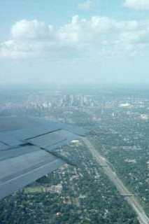
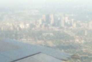
Here is a "closeup" of Downtown Mimmeapolis section of the photo above. It lighter because I use different scanner to make this "enlargement"

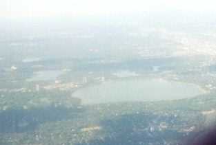
Here is a"closeup" of the three lake from photo above.
Lake Calhoun is the small lake at left.
Lake Harriet is the large body of water in photo.
The lake of the Blues the small lake above Lake Harriet

Links
 
St Paul - Minneapolis International Airport
Omaha's Epply Airfield
Day 1 Photo page:
Como-Harriet Streetcar Line
Last Update on November 3, 2000 17:20 UTC (11:20 am CST)

Home > Trips > Twin Cities Index, Story & Map > Day 5