J. Project
Map

J. Doe Map On
"Directory Doe"

Dir Joe
Divided

Click on area of Interest on "Directory Doe"

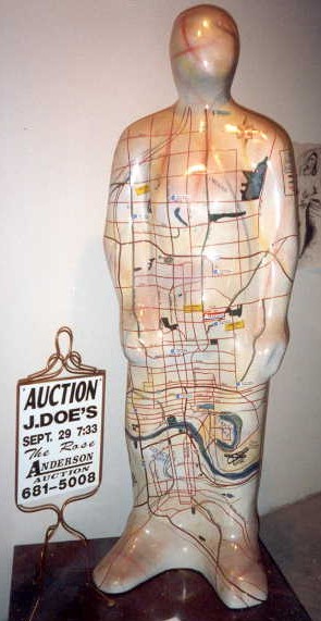
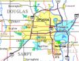
Or see Map on this J. Doe by Area of Town

Image a Map, similar to one at
the bottom of this column, has
been enlarged to man size, turned
90 degrees clockwise and shrink
warp around a J. Doe with north
and south edge of map meeting
in the middle of his back.

Area of Town

  1. West Omaha
    West of 90th Street
  2. Central Omaha
    Between 90th & 36th
  3. North Omaha
    North of Dodge Street
    East of 40th,
  4. South Omaha
    South of Dodge Street
    East of 40th
  5. Downtown
    Cuming  to Levenworth,
    I-480 to 13th street
  6. Old Market
    Dodge to Levenworth Street
    13th to 8th Street
  7. Council Bluffs, Iowa
    & Bellevue, Nebraska


Also see "J.Doe Omaha" map

Map On "Directory Doe" Divided, "J.Doe Omaha" & from "J.Doe Project"
J.Doe Omaha -  Home  -
Lists - Photos - Maps - Links - Auction

Last Update on August  1 , 2001 16:05  UTC (11:25 pm CST)